 Catalogue Datasud
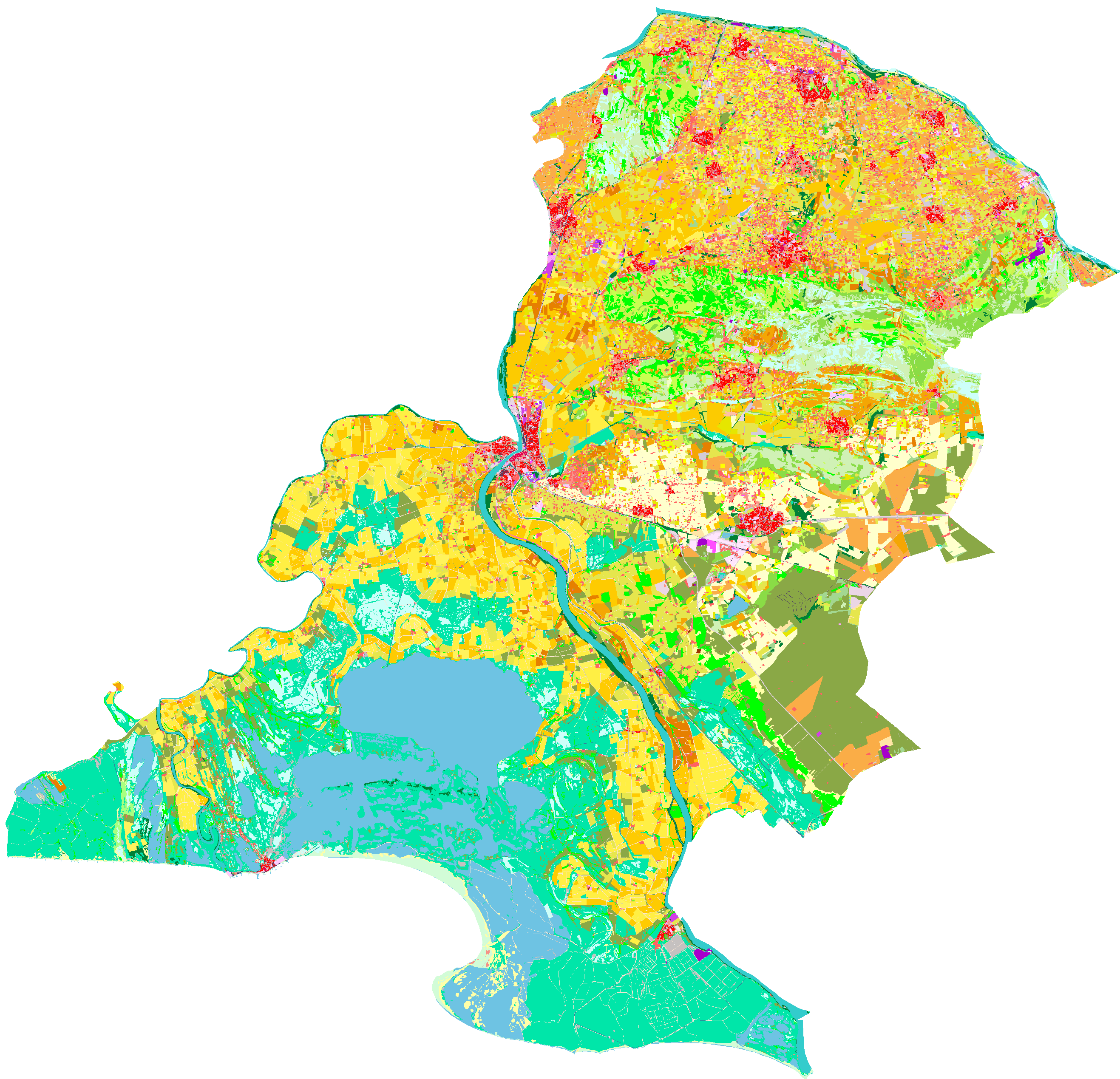
Occupation du sol du SCoT d'Arles_2017
Cartographie des modes d'occupation du sol 2017 sur le SCoT d'Arles, réalisée à partir de la photographie aérienne aux niveaux 1, 2, 3, et 4 d'une nomenclature emboitée conforme au modèle OCSOLGe.
Le projet a été financé par l'Etat/Fonds exceptionnel de soutien à l'investissement public local (50%) et soutenu par le dispositif MOS de la Région SUD (50%)
Simple
- Date (Creation)
- 2020-12-24
- Identifier
-
ff0700d4-5f9e-41d4-a607-9a0b21d6a587
-
GEMET - INSPIRE themes, version 1.0
-
-
Étendue géographique des données
-
- Theme
-
-
MOS
-
agriculture
-
environnement
-
utilisation des sols
-
- Access constraints
- otherRestrictions Other restrictions
- Spatial representation type
- vector Vector
- Metadata language
- freFrançais
- Topic category
-
- imagerie-et-occupation-du-sol
- OnLine resource
-
ocs_mos_paysarles_2017_limscot.zip
(
OGC:WMS
)None
- OnLine resource
-
ocs_mos_paysarles_2017_limscot.zip
(
OGC:WFS
)None
- Hierarchy level
- dataset Dataset
- Statement
-
Non renseigné
- File identifier
- ff0700d4-5f9e-41d4-a607-9a0b21d6a587 XML
- Metadata language
- freFrançais
- Hierarchy level
- dataset Dataset
- Date stamp
- 2019-12-13
- Metadata standard name
-
INSPIRE Metadata Implementing Rules
- Metadata standard version
-
Technical Guidelines based on EN ISO 19115 and EN ISO 19119 (Version 1.2)