 Catalogue Datasud
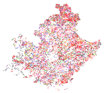
Structures linéamentaires de la région Provence-Alpes-Côte d'Azur.
La cartographie à échelle moyenne (100 000 environ) des structures linéamentaires de la région Provence-Alpes-Côte d'Azur constitue une composante essentielle pour la compréhension de la tectonique régionale.
Etude réalisée par Bernard SIMON STSI/CEREGE en juillet 2004
Simple
- Date (Creation)
- 2014-05-05
- Identifier
-
716bcdb9-b472-4a62-9166-1dc14d1f47ed
-
GEMET - INSPIRE themes, version 1.0
-
-
Étendue géographique des données
-
- Theme
-
-
spatial
-
landsat
-
linéament
-
radon
-
- Access constraints
- otherRestrictions Other restrictions
- Spatial representation type
- vector Vector
- Metadata language
- freFrançais
- Topic category
-
- imagerie-et-occupation-du-sol
- OnLine resource
-
lineaments_paca_2019
(
OGC:WMS
)None
- OnLine resource
-
lineaments_paca_2019
(
OGC:WFS
)None
- Hierarchy level
- dataset Dataset
- File identifier
- 716bcdb9-b472-4a62-9166-1dc14d1f47ed XML
- Metadata language
- freFrançais
- Hierarchy level
- dataset Dataset
- Date stamp
- 2014-05-05
- Metadata standard name
-
INSPIRE Metadata Implementing Rules
- Metadata standard version
-
Technical Guidelines based on EN ISO 19115 and EN ISO 19119 (Version 1.2)