 Catalogue Datasud
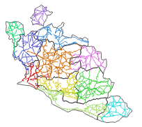
Limites d'exploitation des centres routiers
Limites d'exploitation des voies départementales par centre routier sur le Département de Vaucluse
Simple
- Date (Creation)
- 2024-04-25
- Identifier
-
4bc9c4cf-4b70-46ce-a1af-628edeff33c7
-
GEMET - INSPIRE themes, version 1.0
-
-
Région
-
- Theme
-
-
route
-
route départementale
-
voirie
-
exploitation routière
-
- Access constraints
- otherRestrictions Other restrictions
- Spatial representation type
- vector Vector
- Metadata language
- freFrançais
- Topic category
-
- mobilite-et-transports
- Hierarchy level
- dataset Dataset
- File identifier
- 4bc9c4cf-4b70-46ce-a1af-628edeff33c7 XML
- Metadata language
- freFrançais
- Hierarchy level
- dataset Dataset
- Date stamp
- 2024-04-25
- Metadata standard name
-
INSPIRE Metadata Implementing Rules
- Metadata standard version
-
Technical Guidelines based on EN ISO 19115 and EN ISO 19119 (Version 1.2)