 Catalogue Datasud
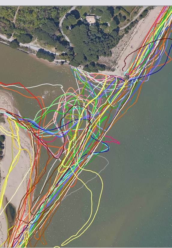
Trait de côte d'Estérel Côte d'Azur Agglomération
Relevé GPS du linéaire côtier d'Estérel Côte d'Azur Agglomération - Anciennement intitulée CAVEM.
Relevé trimestriel, (mars, juin, septembre, décembre) depuis septembre 2011 ( 241 objets exportés)
Simple
- Date (Creation)
- 2021-02-17
- Identifier
-
10cbe64c-0448-443e-960c-902478358639
-
GEMET - INSPIRE themes, version 1.0
-
-
Étendue géographique des données
-
- Theme
-
-
littoral
-
MonLittoral
-
mer
-
GPS
-
suivi scientifique
-
coordonnée
-
trait de côte
-
linéaire
-
- Access constraints
- otherRestrictions Other restrictions
- Spatial representation type
- vector Vector
- Metadata language
- freFrançais
- Topic category
-
- mer-et-littoral
- Hierarchy level
- dataset Dataset
- Statement
-
Non renseigné
- File identifier
- 10cbe64c-0448-443e-960c-902478358639 XML
- Metadata language
- freFrançais
- Hierarchy level
- dataset Dataset
- Date stamp
- 2021-02-17
- Metadata standard name
-
INSPIRE Metadata Implementing Rules
- Metadata standard version
-
Technical Guidelines based on EN ISO 19115 and EN ISO 19119 (Version 1.2)